[ad_1]
“The unapproved boundaries of residential areas are inaccurate, they cross the boundaries of registered land or even buildings, they do not correspond to the boundaries of roads, water and forests. In the event of a disaster and when residents call for help, police, firefighters, or doctors may have difficulty finding the address provided by residents and getting to the disaster site on time.
In addition, due to inaccurate data, residents have problems declaring their place of residence, determining the value of plots on which taxes are paid and farmers declare cultivation areas or receive payments for less favored areas, ”says Kazys Maksvytis, Director of Records of the Center of Records.

Records Center Photo / Kazys Maksvytis
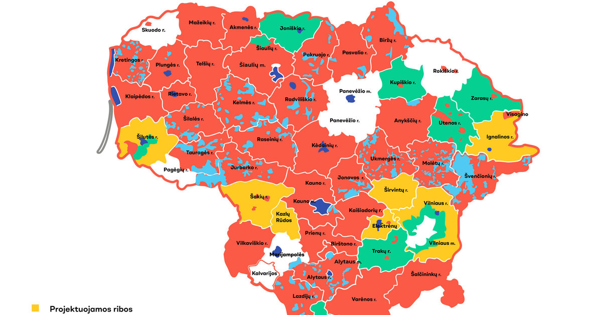
Currently, according to the Registry Center, the limits of residential areas have been established and approved in 46 municipalities of the country. 7 municipalities have not yet done so: Skuodas district, Pagėgiai, Marijampolė, Kalvarija, Rokiškis district, Panevėžys district and Vilnius city municipalities. Plans are currently being drawn up for the delimitation of residential areas in 7 more municipalities.
In order to avoid possible inconvenience to the residents of the aforementioned municipalities, the Registry Center sent reminders to their mayors this week that so far the limits of the settlements in their municipalities have not been approved. Information with a request to mediate was also sent to the Association of Municipalities of Lithuania.
The inaccurate boundaries of residential areas were formed in the first years of the restoration of independence, when during the agrarian reform and without precise limits of the settlements, the authors or surveyors of the land management projects entered the name of a certain area in documents based on unconfirmed data. As a result, situations have arisen throughout the country where, for example, plots with several different settlement names have been registered on the territory of a village.
In accordance with current laws, residential areas are determined and abolished, the limits of their territories are determined and modified by the Government, taking into account the proposal of the municipal council presented after evaluating the opinion of the local population. The settlement delimitation plans are prepared by the municipalities in coordination with the Registry Center, the Ministries of the Environment, Communications and Agriculture. The documents prepared and agreed are sent to the Ministry of the Interior, which presents them to the Government for approval.
[ad_2]