[ad_1]
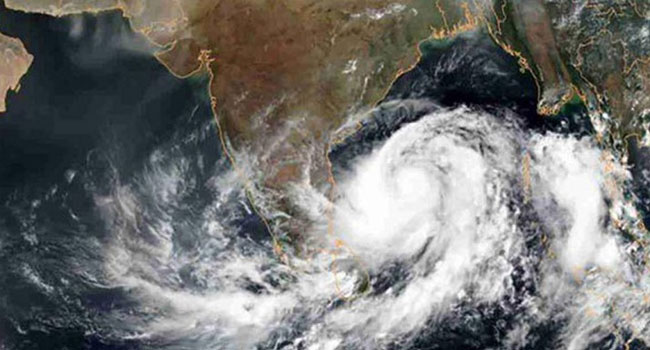
Cyclone Nivar coming from the Bay of Bengal
A new cyclone is forming in the Bay of Bengal. The deep depression over the southwest of the Bay of Bengal will turn into a cyclone and move towards the coast of Tamil Nadu-Pondicherry in India in the next 24 hours, the Indian Meteorological Office said on Monday.
The cyclone known as ‘Nivar’. Iran has named this cyclone.
According to the Indian Meteorological Office, the cyclone is likely to hit Tamil Nadu and Pondicherry on November 25. When hit, its speed can be 100 kilometers per hour.
As a result, it will start raining in the southern coastal states of India from November 23. Heavy to very heavy rains are expected in Tamil Nadu and Pondicherry on November 24 and 25. On the other hand, on the southern coast of Andhra Pradesh, Rayalaseema and Telangana will receive rains on November 25 and 26.
According to the Tamil Nadu Meteorological Department, the deep depression is 640 km south of Chennai. Fishermen have been banned from going to sea until November 25. Because the sea will be very rough at this time due to the strong winds.
Meanwhile, the weather forecast for the next 24 hours as of 9 a.m. today indicates that weather across the country may remain dry with temporary partly cloudy skies. A light fog may fall somewhere in the morning.
According to the synoptic weather conditions, the light pressure in and around the South Bay of Bengal has condensed to a clear light pressure and is located in and around the South-West Bay of Bengal. You can become more concentrated. The extension of the subcontinental high pressure zone may extend to West Bengal and adjacent areas.
There were no significant changes in the weather for the next three days.
Meanwhile, there is no warning for the inland river port until 6pm today and no sign should be displayed.
Sunset in Dhaka at 5:11 pm and sunrise tomorrow at 6:20 am.
Source: Anandabazar and Bass
[ad_2]