[ad_1]

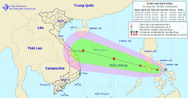
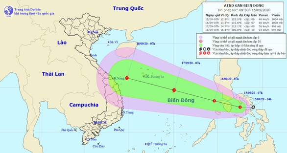
Tropical low pressure roadmap – Photo: National Center for Hydrometeorological Forecasts
The National Center for Hydrometeorological Forecasts for the next 24 hours, the tropical depression moves in a northwest direction, every hour it travels about 15 km, enters the East Sea and is likely to be stronger.
Authorities warn that all ships operating in the waters between the Hoang Sa Archipelago and the Spratly Islands must pay attention to storm reports to avoid them.
Next time, the tropical depression will keep its direction in a northwesterly direction, at 15-20 km per hour and it is likely to become a storm.
On the morning of September 17, the storm forecast was about 400 km southeast of the Hoang Sa archipelago. The strongest wind in the area near the center of heavy storms is level 8-9 (60-90 km / hour), level 11.
Today, the low pressure trench with an axis that crosses the South Central region tends to lift the axis towards the north, in addition the southwest wind will cause heavy rains in the South region.
As of tomorrow, this low pressure trench consolidates into a tropical convergence band that connects with the tropical depression in the sea. Also, the southwestern monsoon in the south from September 16 to September 19 tends to be more active, so the rain in the southern region will remain until September 20 and then gradually decrease.
The northern region will be influenced by the convergence of strong winds combined with cold air, so there will be heavy to very strong rains.