[ad_1]

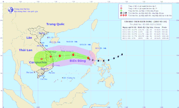
Forecast of the trajectory of storm number 10 in the East Sea – Photo: National Center for Hydrometeorological Forecasts
At 4:00 this morning, November 2, the position of the storm was at about 14.3 degrees north latitude; Longitude 119.2 degrees east, about 820 km from the Hoang Sa archipelago to the southeast. The strongest wind near the center of strong storms is level 9 (75-90 km / h), level 12. Strong wind radius from level 6, shaking from level 8 or more about 180 km from the center of Storm.
It is forecast that in the next 24 hours, the storm will move in a northwest direction, every hour is 15-20km. At 4:00 am on November 3, the location of the storm’s center is at about 15.2 degrees north latitude; Longitude 115.0 degrees east, 340 km southeast of the Hoang Sa archipelago. The strongest wind in the area near the center of strong storms is level 8-9 (60-90 km / h), level 11.
East Sea Storm Hazard Zone in Next 24 Hours (Strong Winds from Level 6 or Higher, Bumps from Level 8 or Higher): latitude 12.0 to 17.0 North; from the 112.5 meridian to 120.0 degrees east longitude. All vessels operating in the danger zone are at high risk of being hit by strong winds.
During the next 24 to 48 hours, the typhoon moved mainly westward, traveling between 15 and 20 kilometers per hour.
At 4:00 am on November 4, the location of the center of the storm is at about 14.9 degrees north latitude; 111.2 degrees East Kinh, about 310 km from Quang Nam, 240 km from Quang Ngai and Binh Dinh, about 260 km from Phu Yen. The strongest wind near the center of strong storms level 9 (75-90km / h), level 12.
For the next 48 to 72 hours, the typhoon moved mainly west, every hour for 10 kilometers, inland from Da Nang to Phu Yen and weakened into a tropical depression.
At 4:00 am on November 5, the location of the center of the tropical depression is approximately 14.7 north latitude; 108.6 degrees east longitude. The strongest wind in the region near the center of the strong tropical depression level 6 (40-50 km / hour), level 8.
For the next 72 to 96 hours, the tropical depression moves in a southwesterly direction, about 10 km per hour.

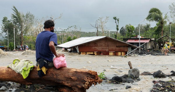
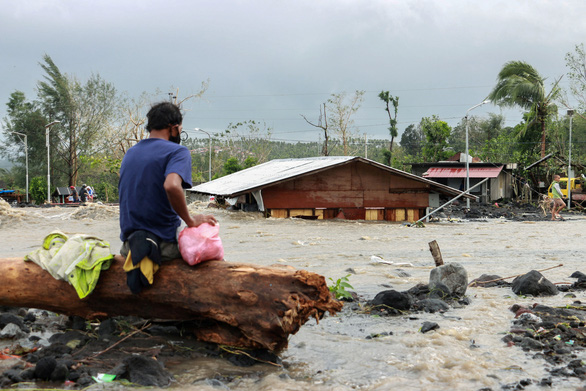
People in Daraga City, Albay Province, Philippines, were damaged by Super Typhoon Goni on November 1 – Photo: REUTERS
In the Philippines, Typhoon Goni is considered the main hurricane this year, according to the Reuters news agency. The Philippine Civil Protection Office (OCD) reported that at least 10 people were killed and three others missing when Super Typhoon Goni passed through the southern region of the island of Luzon.
The OCD announcement said that super typhoon Goni displaced 390,000 people, of whom more than 345,000 were temporarily residing in government evacuation centers.
Thousands of soldiers and police officers are being placed on the ground to assist with evacuation and rescue efforts.
New images posted by the Philippine Red Cross on Twitter show soldiers passing through flooded areas in Batangas province to rescue stranded residents.
In some of the affected areas, the power supply is cut off, causing the interruption of communications. Furthermore, traffic in some mountainous areas is also affected by landslides.
Super Typhoon Goni is the twelfth tropical storm to hit the Philippines this year and is the second strongest hurricane to hit the Southeast Asian country in more than a week, following Storm Molave that killed 22 people and sank. many houses and villages.