Countries and regions have implemented variable restrictions, depending on the severity of their outbreaks, and that has complicated travel.
“COVID-19 has certainly impacted the way we move around the world,” said Google Maps director of product management, Ramesh Nagarajan, in a press release in June.
“As cities and countries around the world adapt, we are committed to bringing the most relevant information at your fingertips. So when you are ready and able to do it, you can safely venture,” said Nagarajan.
To help travelers, Google Maps collects data from local and national agencies and governments and alerts users to relevant information.
This is what users can expect:
Restriction alerts
Google Maps users will receive driving alerts to notify them of Covid-19 checkpoints when they cross national borders, as well as variable restrictions along their routes.
Drivers will see the alert on the instructions screen if they enter an area affected by certain restrictions, such as a mask mandate or social distancing regulations.
Checkpoints and restriction alerts are currently available in Canada, Mexico and the United States.
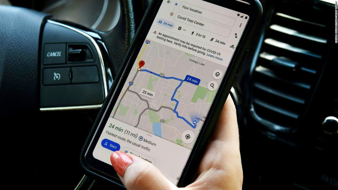
Test alerts
When someone drives to a coronavirus medical center or testing center, they will receive alerts reminding them of the center’s eligibility and guidelines, “to avoid being rejected or causing additional strain on the local health system,” Nagarajan said.
Alerts for medical facilities are available in Indonesia, Israel, the Philippines, South Korea, and the US Test center alerts are available in the US
Public transportation alerts
When using Google Maps to navigate public transportation in an area affected by Covid-19 restrictions, travelers will receive alerts from local transit agencies with reminders of regulations, such as mask requirements or if government mandates are affecting the services of transit.
Traffic alerts are being implemented in Argentina, Australia, Belgium, Brazil, Colombia, France, India, Mexico, the Netherlands, Spain, Thailand, the United Kingdom, and the United States.
In 2019, Google Maps introduced overcrowding predictions for public transportation using millions of passenger contributions to show people how crowded bus or train lines are. It is now easier for people to present their own overcrowding experience and see how busy a train or bus they are about to catch is usually.
This will help travelers practice social distancing by avoiding crowded trips and planning their trip in times that are not as busy.
.
